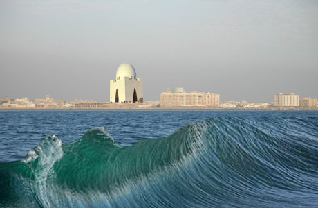
Villagers in Pakistan face threat
from rising seawater
By
Tehmina Qureshi
 The
intrusion of the Arabian Sea into the mouth of the Indus
River on Pakistan's southern coast is eroding land, forcing
whole villages to relocate inland, and threatening fishing
livelihoods, residents and environmental experts say.
The
intrusion of the Arabian Sea into the mouth of the Indus
River on Pakistan's southern coast is eroding land, forcing
whole villages to relocate inland, and threatening fishing
livelihoods, residents and environmental experts say.
As sea levels rise
globally, low-lying coastal areas become vulnerable to the
incoming saltwater.
The sea’s intrusion into
the once-thriving Indus Delta in the coastal Thatta district
occurs mainly because the Indus River does not carry enough
water below the Kotri Barrage, a major dam 190 miles north
of the coast, to hold back the saltwater from the river and
its network of creeks and mudflats.
The seawater intrusion turns
fields and underground drinking water saline, makes land
waterlogged and reduces fish catch.
In the early 20th century, the area was famous for
production and export of red rice and fish. For centuries
earlier, it was a center of trade and scholarship, partly
due to the old port at the seafront town of Keti Bunder. Now
the survival of this part of the dying delta region is
threatened.
Local lawmaker Humera Alwani of the opposition Pakistan
People's Party says that at the current rate of erosion, the
6,700-square-mile district of Thatta, with its population of
1.1 million, could be gone by 2025.
The effects and threats of the inflow and erosion are
pronounced in Keti Bunder.
Mohammad Saleem, a lifelong
Keti Bunder resident, watches daily as the sea erodes the
earthen dike, near his wooden house.
Ten years ago, a few miles separated his house from the
muddy waterline. Now, he points to a spot seemingly far out
to sea where his and his neighbors’ homes used to be before
encroaching seawater forced them out.
"We had to move here and set up our village all over again
because the sea had entered our village over there," he
said.
Houses are set on posts 2 feet off the ground.
Villagers will have ample time to leave if the sea makes its
way to their village again after eating through the dike.
The water flowing near Saleem's home used to be drinkable --
from the Indus River -- but now it is all saline. He says
the shoreline used to be a few miles farther out, meaning
that river water used to surround the area until its flow
was reduced, allowing seawater in.
The PPP's Alwani has
predicted that if the sea level rise and seawater intrusion
continue at the current pace, Thatta and a neighboring
district, Badin, will be gone by 2025.
"Around 80 acres of land have been eroded by the sea in
Thatta district alone. There used to be seven ports here but
all of them were destroyed by the encroaching sea," Alwani,
a member of the Sindh assembly, told UPI Next.
Over the past 30 years, the Arabian Sea has devoured about
1.2 million acres (1,875 square miles) of land from the
coasts of both districts, says Abdul Majeed Nizamani,
chairman of the Sindh Growers' Board, which represents
farmers, landlords, peasants and others involved in
agriculture.
"The Sindh Development Review 2008-2009,” a provincial
Planning and Development Department report, cites a study
estimating Keti Bunder mudflat erosion at 66 feet per year
with the rate in one of the four major creeks near the town
was as high as 5,500 feet per year.
Though no official records exist, 34 of the sub-district's
42 settlements have disappeared under the sea, said Zahid
Jalbani, a program manager at Strengthening Participatory
Organization, which specializes in development advocacy.
The intrusion accelerated after a dam was built at the town
of Kotri in 1955 to divert fresh water for irrigation and
flood control, Jalbani said.
"The flow of freshwater in the Indus Delta is too low to
push the seawater back and sustain the areas in and around
it," he told UPI Next.
"As a result, the seawater creeps up the river channels,
affecting the whole ecosystem of the area. The original
residents of Keti Bunder were not fishermen but farmers. The
region used to be famous around the world for the production
of red rice."
Since water reserves have been destroyed by salinity and the
land is too barren to grow anything, more than 90 percent of
the population rely on fishing as their main source of
income, Jalbani said.
"But sea intrusion and changing weather patterns have also
badly damaged the fish catch," he said.
The Sindh Development Review states freshwater discharge
from the Indus River into the delta has plunged from 49
trillion gallons 60 years ago to 235 billion gallons in
2006.
Although the International Union for the Conservation of
Nature, an international environmental organization, has
calculated the required flow at the delta to be 8.8 trillion
gallons, the flow has been less than 3.3 trillion gallons
for the past two decades.
The only exception was 2010 when the country was ravaged by
a massive flood.
The effects of saltwater intrusion can be felt up to 40
miles upstream, the Sindh Development Review report found.
Shakeel Memon, a Keti Bunder activist, said the only source
of drinking water is from tankers filled 40 miles inland.
"We have had no [local source of] drinking water for the
past 20 years," Memon told UPI Next.
"Before that, the river channels used to be full for at
least a couple of months during monsoon season."
A 2012 report by the Pakistan Meteorological Department,
“Climate Change in Pakistan Focused on Sindh Province,”
states about 5,300 glaciers in northern Pakistan are on a
steady retreat, while in coastal areas, especially in the
Indus Delta region, temperatures are on a constant climb.
Moreover, it found the sea level rising at about one-tenth
of an inch per year.
The report predicted the situation would get much worse.
It said the frequency of droughts and floods in the delta
had increased considerably during the previous decade.
Increased tidal and storm activity in the Arabian Sea was
causing more saltwater intrusion and coastal erosion,
hindering agriculture and depleting fish stocks and
mangroves.
April, 2014
Source:
UPI